Remote sensing of air pollutants and greenhouse gases
We develop algorithms to retrieve NO2 and CH4 maps from the spectral radiance information provided by airborne imagers. The maps are used to characterize NO2 and CH4 distribution and to obtain detailed information on individual emission sources. In the long run, the activities will improve remote sensing and modelling of air pollutants and greenhouse gases. They will allow environmental monitoring at the scale of cities with remote sensing techniques from aircraft and other platforms in order to support policy makers and as a critical input for epidemiological studies.
Trace gas retrieval algorithms
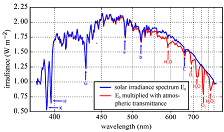
We develop algorithms for the retrieval of NO2 and CH4 from airborne imaging spectrometers using differential optical absorption spectroscopy (DOAS). For this purpose, we have developed the flexDOAS library, which is an open-source Python package for DOAS analyses. The code is available on our GitLab page: https://gitlab.com/empa503/remote-sensing/flexdoas.
3D radiative transfer modelling
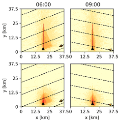
At city scale, the assumed horizontal homogeneity of the atmosphere and the surface properties induces spatial smearing and biases on retrieved trace gases from high-resolution airborne imaging instruments. To study those effects, we extended the 3D features including complexe surface properties (buildings) of a radiative transfer model (libRadtran) in close collaboration with Remote Sensing and Radiative Transfer group at Ludwig Maximilian University of Munich.
Measurement campaigns
We conduct measurement campaigns to measure the spatial distribution of NO2 and CH4 with airborne sensors. In addition, we conduct ground-based observation for validating the remote sensing products. We collaborate with the Satellite Remote Sensing group the Max Planck Institute for Chemistry (MPIC) and the Trace Gases group at Ludwig Maximilian University of Munich.
Publications
- Kuhlmann, G.; Hueni, A.; Damm, A.; Brunner, D. An algorithm for in-flight spectral calibration of imaging spectrometers. Remote Sens. 2016, 8 (12), 1017 (24 pp.). https://doi.org/10.3390/rs8121017
- Popp, C., Brunner, D., Damm, A., Van Roozendael, M., Fayt, C., and Buchmann, B.: High-resolution NO2 remote sensing from the Airborne Prism EXperiment (APEX) imaging spectrometer, Atmos. Meas. Tech., 5, 2211-2225, doi:10.5194/amt-5-2211-2012, 2012.
- Schwaerzel, M., Emde, C., Brunner, D., Morales, R., Wagner, T., Berne, A., Buchmann, B., and Kuhlmann, G.: Three-dimensional radiative transfer effects on airborne and ground-based trace gas remote sensing, Atmos. Meas. Tech., 13, 4277–4293, https://doi.org/10.5194/amt-13-4277-2020, 2020.
- Schwaerzel, M., Brunner, D., Jakub, F., Emde, C., Buchmann, B., Berne, A., and Kuhlmann, G.: Impact of 3D radiative transfer on airborne NO2 imaging remote sensing over cities with buildings, Atmos. Meas. Tech. Discuss. [preprint], https://doi.org/10.5194/amt-2021-129, in review, 2021.


